09/28/2026
The sedimentary rocks that contain most fossils were deposited by moving water, wind, volcanic activity, or other processes that can transport and bury sediment. In many locations, these deposits are extraordinary in scale. Thick sequences of sandstone, shale, and limestone extend across hundreds or even thousands of miles, raising an important question: What processes could transport and deposit sediment on such an enormous scale?
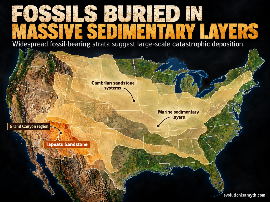
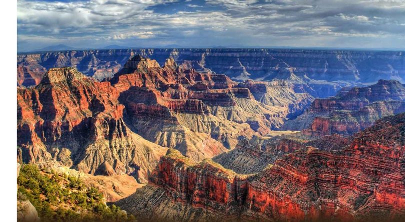
The Grand Canyon provides one of the clearest examples. According to the National Park Service, the conspicuous Paleozoic sedimentary rocks exposed in the canyon total about 2,400 to 5,000 feet thick. These include sandstone, shale, and extensive limestone formations deposited in environments that conventional geology largely interprets as ancient seas and coastal settings.¹ The canyon exposes nearly 40 identified rock layers altogether.²
One particularly interesting formation is the Tapeats Sandstone, near the base of the fossil-bearing Cambrian sequence. The U.S. Geological Survey describes it as a coarse-grained sandstone containing locally conglomeratic material and recognizes it as a marine deposit. Within the Grand Canyon, it can reach approximately 300 feet thick, although its thickness varies considerably from place to place.³
The Tapeats is important because it is not merely a thin local deposit. Similar Cambrian sandstone units occur over vast portions of North America. Geologists interpret these deposits as resulting from a major marine transgression, when seas advanced far across the continent. From a Flood perspective, however, the tremendous geographic scale of such sedimentary systems is exactly the sort of evidence that deserves attention when considering enormous continental-scale water movement.
CATASTROPHIC DEPOSITION IS OBSERVABLE
Modern geology no longer assumes that every sedimentary layer formed slowly and quietly. Catastrophic events can transport tremendous quantities of sediment in remarkably short periods. Volcanic eruptions, turbidity currents, hurricanes, tsunamis, debris flows, and catastrophic lake failures can rapidly erode material and redeposit it elsewhere.
This distinction is important. Rapid deposition does not, by itself, prove the biblical Flood, but it shows that thick sedimentary deposits do not necessarily require slow, grain-by-grain accumulation under conditions comparable to those observed on a quiet modern seafloor.
The question therefore should not simply be, “How old is this layer?” but also, “What physical conditions were required to produce it?”
MARINE ROCKS ACROSS THE CONTINENTS
Perhaps even more striking is the widespread presence of marine sedimentary rocks far inland. At the Grand Canyon, mainstream geology itself interprets many of the fossil-bearing layers as products of shallow seas that repeatedly covered the region. The National Park Service states that Paleozoic marine incursions deposited thousands of feet of sandstone, shale, and limestone across the area.¹
Finding marine deposits in the interior of continents is therefore not disputed. The disagreement concerns their history. Conventional geology interprets the formations as the products of multiple environments and marine advances separated by immense periods of time. A biblical Flood model asks whether at least some of these enormous formations could instead record stages of a much larger period of catastrophic continental inundation, sediment transport, burial, and retreat.
That is a more defensible argument than simply claiming that “thick rocks prove the Flood.”
THE SCALE IS THE QUESTION
Individual sand grains do not tell us how quickly an entire formation accumulated. We must consider the deposit’s physical characteristics: its geographic extent, thickness, sediment grain size, fossils, sedimentary structures, erosional contacts, and relationship to formations above and below it.
When sedimentary formations containing marine organisms extend across enormous portions of continents, the scale of the process that produced them deserves serious consideration.
A global Flood interpretation therefore does not depend merely upon the existence of sedimentary rock. Rather, it points to the combined pattern of enormous sedimentary systems, marine fossils far inland, extensive erosional surfaces, and evidence that catastrophic water movements can accomplish major geological work rapidly.
That evidence does not force one interpretation, but it makes catastrophism essential to any discussion of Earth’s sedimentary record.
SOURCES
¹ National Park Service, “Geologic Formations, Grand Canyon National Park.” The NPS reports approximately 2,400–5,000 feet of Paleozoic sandstone, shale, and limestone deposited during coastal and marine incursions. National Park Service
² U.S. Geological Survey, “Geology of Grand Canyon National Park,” and National Park Service Grand Canyon stratigraphy. USGS
³ U.S. Geological Survey, Geolex, “Tapeats Sandstone.” Historical USGS measurements report thicknesses reaching roughly 285–300 feet and identify the formation as marine.